
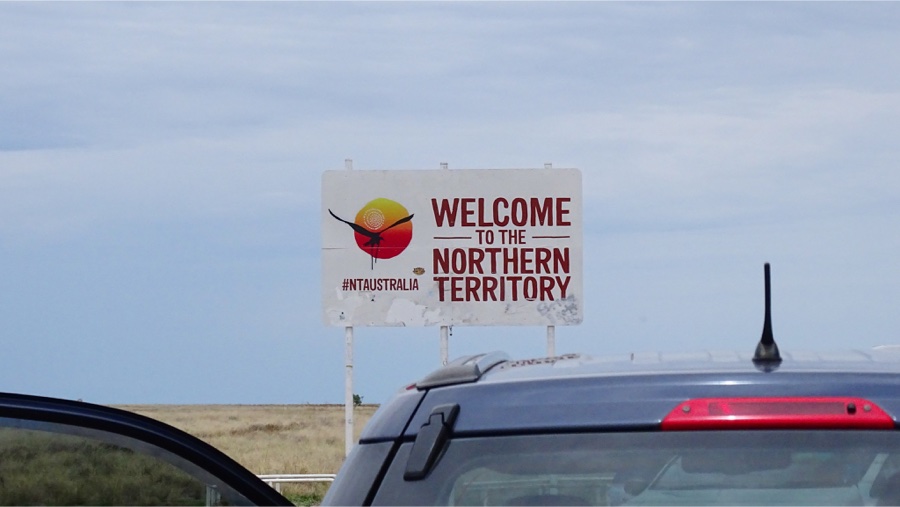
Northern Territory
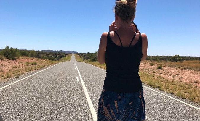
 After meeting some authentic countryside Aussies we thought we were ready for the real thing… but life in the Red Center of Australia is something else. Something completely new. Hermit farmers, extreme heat and a whole lotta nothing. What started as just an adventure ended in absolute amazement… the beauty in this central part of the country is beyond compare.
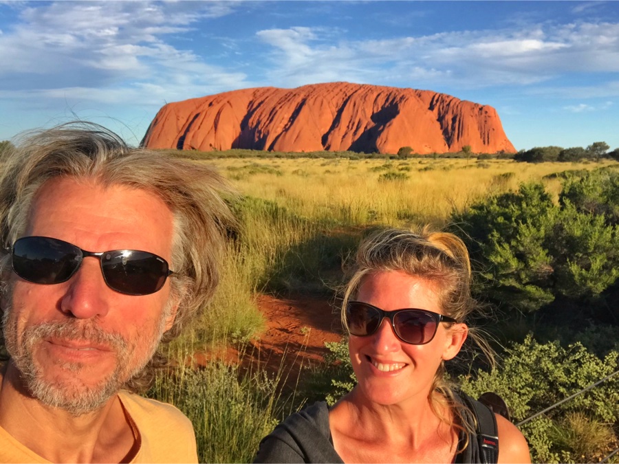
With Ayers Rock as our goal we discovered so much more hidden gems along the way, this big red blob was just the cherry on the cream.
 We continue our roadtrip through the outback of Australia and stop at Barkly Homestead along the Barkly Highway a.k.a. Route 66. A campsite with a bar/restaurant and a shop where you can buy an apple for $ 4.00 and 12 paracetamol for $ 12.50. Yep we are in the middle of nowhere.
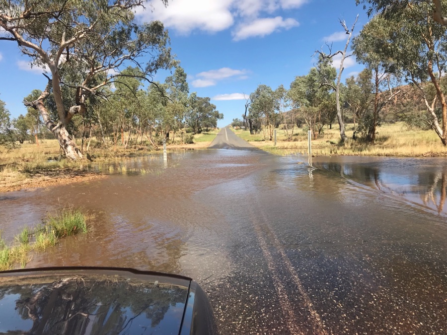
We need to refill on our petrol again, the prices go up as you enter nomansland, so we pay $ 1.80 for regular unleaded. There aren’t to many petrol stations so whenever we get the chance we fill up, which is about every 300 kilometers.
 The Barkly campsite is very muddy and only one of the sanitary blocks is open so we find the most dry and shady spot we can find not too far from the toilets but just far enough for the smell.
Today has been a cool day. Only 28 degrees and a lot of rain. We are quite relaxed and not overheated for a change. Gooood.
From 4 to 5 there’s happy hour in the pub, we decide we’ve earned a beer which we combine with the local WiFi. $ 4.00 for a bottled beer of our choice. Mmm… the Pale Ale tastes good.
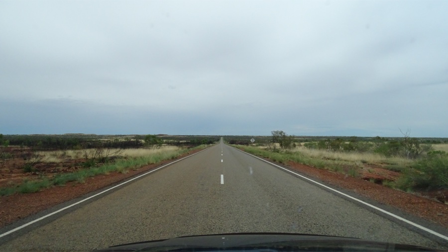
 The trip between Tablelands and Tennant Creek is definitely the most boring part of our journey. Small dry bush, flat horizon. No variation at all, except for the dressed termite hills and some daring lizards crossing the road. Some unfortunate grilled ones. The ticking of the bugs hitting our windscreen is very rhythmic, tic-tic-tic… after two hours we really need to scrub our window to see through again.
Many small graves by the roadside that remind you to drive carefully on these long straight roads.
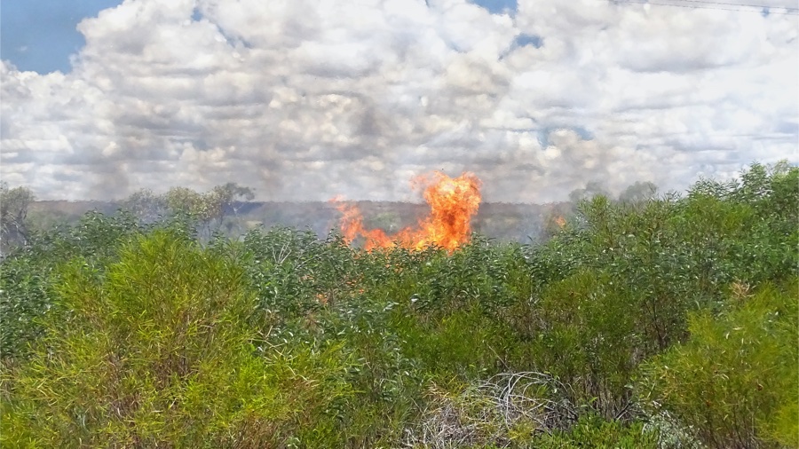
After passing Tennant Creek the surroundings appear to change slightly. More trees less drought. But then we spot a big smoke plume that we’re driving towards. There’s a huge area burning and the flames are hot and high. There are already some people there making calls so we drive on to our next stop. Phew impressive.
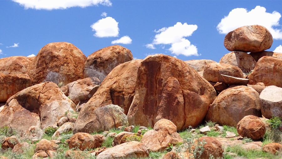
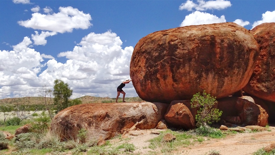 We stop at the Devils Marbles Conservation Reserve. It’s an incredibly hot day and eventhough it’s 10:30 it’s already 36 degrees. Our time outside is limited so we park in a small piece of shade and look around before we exit the car.
The boulders are amazing. The round marblestone and limestone boulders are believed to be eggs of the rainbow serpent and turned to stone by the devil. An ancient Aboriginal tale…
There’s a campsite behind the marbles that looks very cool but is actually burning hot. Too bad we still have a whole day ahead, would have been amazing to camp here!
 We drive on for another ten kilometers where a pool is waiting for us. We camp at the Devils Marbles Hotel. Just like any other campsite or motel, the ambiance is hard to find, corrugated fences and ugly bungalows. The camping area has grey gravel and there’s a small grass area for camping.
It’s another hot day in paradise and we’ve heard there is a pool so we go for a cool down swim. Ahhhyeah, the pool is excellent! Like a little oasis in the desert it’s clear blue and surrounded by green. We enjoy ourselves there the whole afternoon before we make ourselves a great dinner.
 We sleep with the back door open but of course that’s an invitation to all insects. Come on in fellows, party is here! A huge grasshopper the size of our hand jumps around in our bed and many mosquitoes, flies and undefinable bugs decide to join him in his psychic episode.
We need a mesh net.
Back on the road we are lucky with cool weather. It’s 8 am and the temperature is only 23 degrees. We have 400 kilometers to go and the only thing breaking the monotonous straight road is a rain of bugs totally besmirching our windshield.
Along the Stuart highway we pass McDouall Stuart rest stop. We stop for a short break and make a cup of coffee. It’s a nice resting area and eventhough the flies carry us away we enjoy the peaceful scenery. John McDouall Stuart (after whom this highway is named) once calculated this to be the absolute center of Australia. But later he appeared to be wrong and the center was considered to be Ayers Rock.
After passing the tropic of Capricorn the surroundings are better and better. Hills, green and colorful nature and we even pass the highest point marker of the Northern Territory which doesn’t say how high it is.
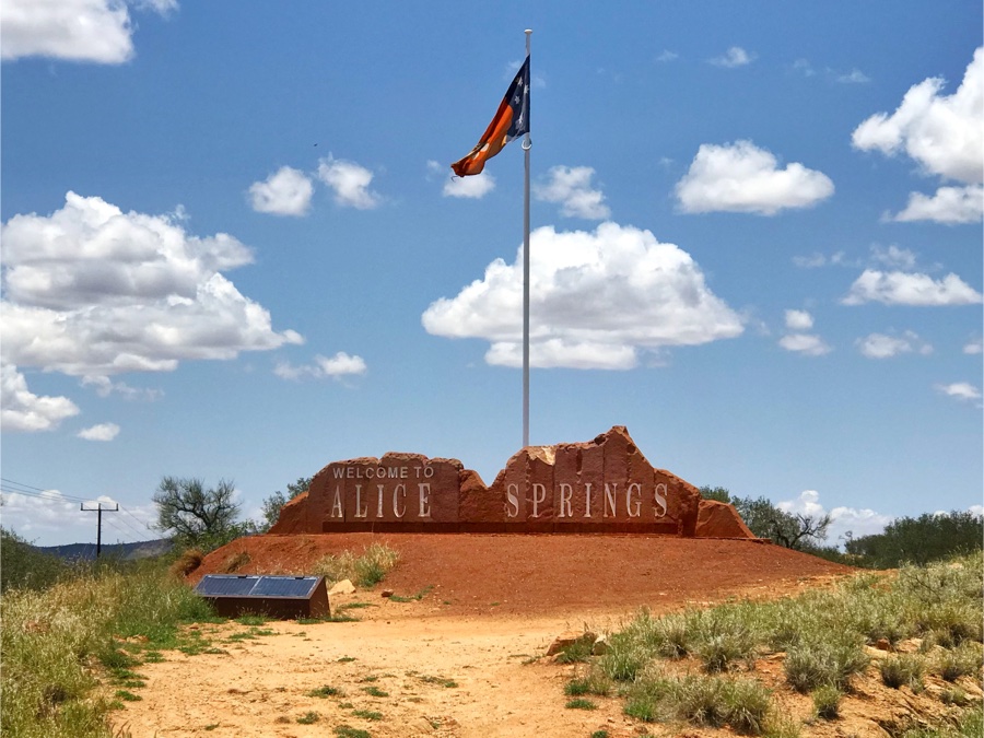 Entering Alice Springs the views are spectacular, rough red rocks and palmtrees. An oasis in her dessert. It turned into another hot day so we check in to an air conditioned twin room at the Jump Inn hostel. Two separate beds for a change is not too bad!
The next two days the temperatures hit well above 40 degrees so we don’t see much of Alice Springs. The hostel has a pool and a great kitchen so all we need is some groceries and we are complete.
Alice Springs is a medium size town with big supermarkets, a Kmart and a Bunnings. There is a hospital and a lot of restaurants and pubs. An old telegraph station is one of the only historical highlights of this town.
 If you want the real good stuff, you need to go West!
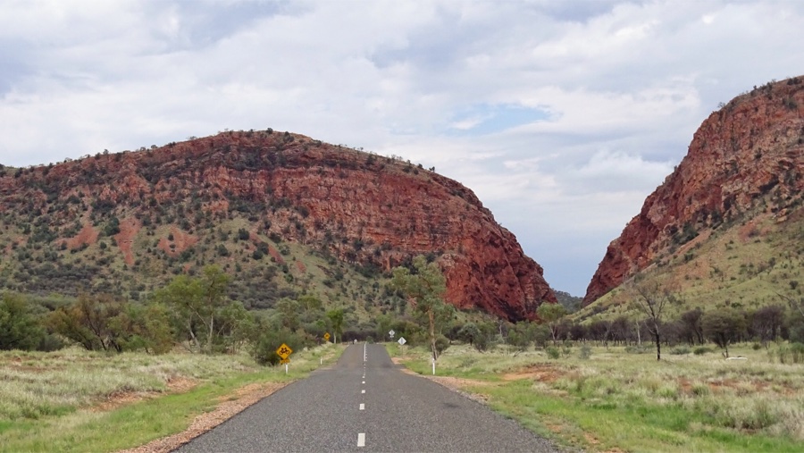
About 90 kilometers west of Alice Springs there is the West MacDonnell National Park. A colorful long stretched mountain area with lots of awesome surprises. The altitude of 700 meters lets the temperatures drop a few degrees and especially at night it can be quite chilly.
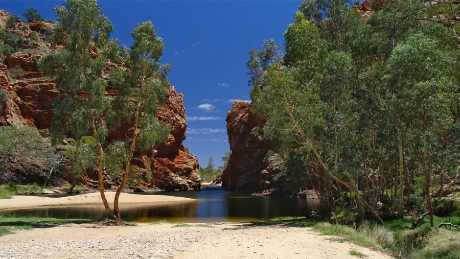
 We drive along the impressive MacDonnell mountains and make a short stop at Simpsons Gap where two huge mountains meet.
The red stone walls and a small creek in between make it look like a movie set. There’s no water in the river running towards it but just a dry sandy bedding with some trees fighting for their existence.
 Our first stop is at Standley Chasm, about ten kilometers of the main road. There is a small restaurant and a campsite with facilities. We are the only ones camping there tonight.
The entrance of the park is $ 12.00 per person but if you camp you pay $ 18.50 pp, including the entrance fee. Not cheap but hopefully it will be an unforgettable experience.
The area belongs to an Aboriginal community who live entirely off the entrance fees and income of the restaurant. They maintain the area very well and
When we arrive we are offered a cup of coffee and after that we look for the right shady spot to put the car.
The flies are incredibly annoying, they sit on your eyes and mouth and buzz around our ears aggressively but as soon as it’s dark they disappear and we can relax again. After yet another culinary adventure we drink our last wine by the campfire along with some good conversations.
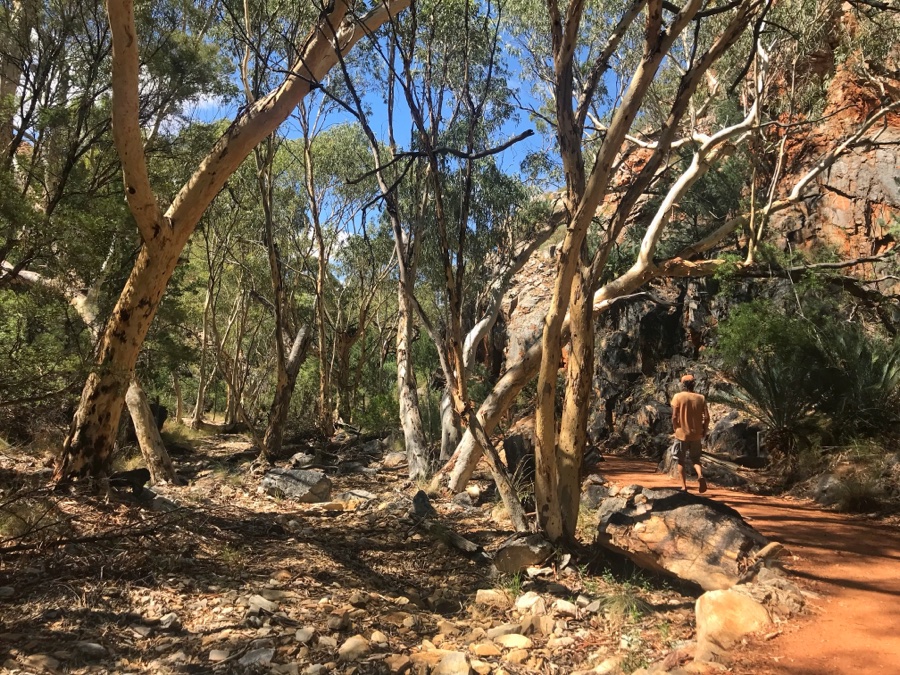
Early in the morning we walk towards the chasm, it is amazing and very cool. The big gap between two immense rocks was caused by a movement in the earths crust millions of years ago. Around noon the sun shines directly into the gap and lets the rock shimmer and glow.


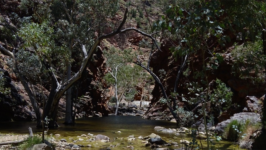
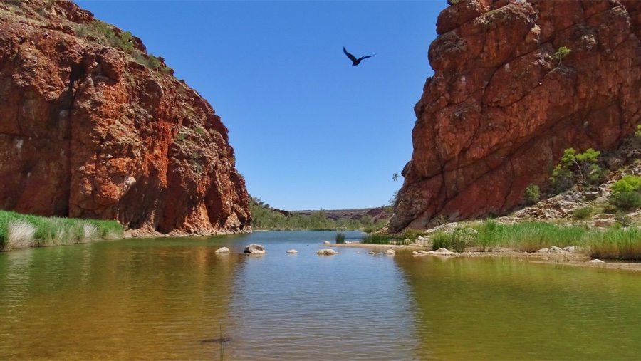
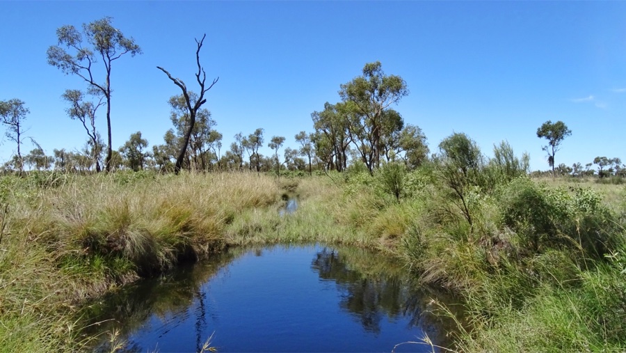
 We make a stop at Ellery Creek Big Hole. It’s just off the main road along the MacDonnell and there is an unpaved road that leads you to an amazing waterhole.
The road is in good condition so our 2 wheel drive has no trouble arriving in one piece. Again the rivers are dry but the scenery is breathtaking.
 Next in line of hot points is yet another gorge. We follow a hot dry trail with lots of flies for about a kilometer. A beautiful trail with birds singing but unfortunately with a slightly disappointing end. Plus the sun shines so brightly all of our pictures failed bigtime, thank goodness for visual memories.
It does have potential tho, this might be one of those places which are more attractive in the winter when water flows richly. The flies don’t mind any of this, they are well represented.
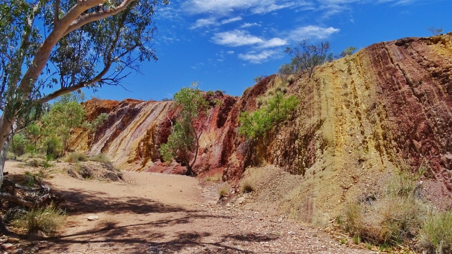
 Just ten kilometers further we find yet another breathtaking rock formation, but of a different kind. The Ochre in the stones have many tints of yellow and make it look like a rainbow. It’s absolutely amazing to see and gladly the colors show on the pictures as well! This must be extraordinary when wet!
Walking back to the car whilst violently waving at the flies that seem to love my face I almost choke on one. I’VE HAD IT! Back into the car!
 After cooling down a bit we decide to visit one more wonder of nature. About ten kilometers of the main road this impressive red stone gorge has different hiking trails and a big fresh water hole for swimming. There is a camping area which looks wonderful and a small coffee shop. The first thing we notice, no flies! Let’s stay here…
After a nice break we go back to the car and drive further towards our goal for today.
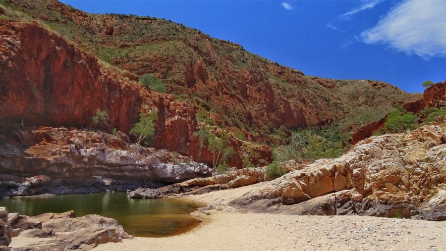
 Here we find another magnificent viewpoint. There’s a very deep water hole suitable for swimming but as all other holes we’ve seen the water is green and looks dirty, probably due to hot temperatures. So we feel no urge to jump in. The temperature today has gone up to 29 degrees and there is a cool breeze. We are so happy today!
At the foot of Glen Helen there is a hotel and campground, a petrol station where you pay $ 1.80 per liter and a small basic shop.
Like most of the sites we’ve visited we expect it to look so much better with a bit more water. But on the other hand how often can you walk on the river bed.
 Our final destination for today is camping at the Redbank, the most western part of the MacDonnell mountains. From the main road we follow a dirt road for 5 kilometers. While we carefully drive at 20 km/h we get overtaken by two 4 by 4’s who fly by like maniacs. Hmm…
We camp here tonight at Woodland Camping area, a very charming campsite with a fireplace and cooker at each site. They ask for a donation of $ 10.00 that you can put in the box at the entrance. We decide to look at the sites first and when we find a nice site we prepare our gear for the night.
While we sit and relax without flies there is a wandering bee that loves my leg. After a while there are two, three… and then suddenly we discover what they are up to. They are gathering for a feast on the grille of our car. Must be a hundred sitting in the holes of the grille. Oh god, bee attack! Let’s get out of here!
We quickly pack our gear and drive off. A few hundred metres further we stop to see if the bees are still there. We see some flying around so decide we leave the campsite and drive to Hermannsburg. Otherwise we would have gone there in the morning anyway. If we leave now we can make it before dark.
When we reach the highway we realise we haven’t seen the Redbank Gorge… shit!


 We have about a hundred kilometres to go between Redbank and Hermannsburg. The road in between has only been sealed a few months ago so it will be an easy drive. In an hour the sun will set but we still have some time to stop at Tylers Pass. On top of the hill there’s a loop that gives you a gorgeous panoramic view over the whole area. Too bad you can’t see how impressive this is… This must be the best viewpoint EVER! I say, let’s camp here tonight…
Unfortunately the fines for camping where it’s not allowed are really nasty 🙁
 It’s half past six when we arrive at the precinct where we planned to stay tonight. There is a big sign that says closed, and we realise they are only open until five. Just as we walk back to the car I see a lady coming towards us, she show us the way to the campground and we are in! There are some toilets and one shower and we pay a donation of $ 10.00.
We find a really nice spot under the dade palmtrees and we are the only ones there. We’ve already spot some of the wild horses that live around this area. This is so special!
After cooking dinner we enjoy a nice campfire we are visited by a happy wagging dingo. After we send him away he disappears as quietly as he came.
 The nights in the mountains are cold and even with a fleece blanket over our sheet my legs are crampy in the morning. Must wear more clothes next time.
From Hermannsburg to Kings Canyon there are two options, west or east.
Go west, there is only 250 kilometers to go of which 150 unsealed road. With a normal 2 wheel drive car this takes about six to seven hours and whit a rental car it’s even prohibited. Furthermore the scenery is supposed to be nothing special. And then there is east, 600 kilometers on a nice bitumen road with at least some campsites and a petrol station along the way. In the context of taking things slow, we go east.
 We make a short stop at a camel farm along Stuart Highway. Camels, dromedary, an emu and a few lamas live in a bold sandy area with a simple fence to keep them in. Here you can do dessert tours on the back of a camel but we’re not sure why the other animals are here. We expected the worst but strange enough there are no flies here. Yay.
After taking some pics and giving the animals some peptalks we are back on the road.
 The weather forecast says we have lower temperatures for the next three days. This happens when the wind changes direction, in this case it means the difference between 40 or 30 degrees. So we make another quick decision and drive towards Uluru in one go. Tomorrow will be only 27 degrees so we grab that opportunity with four hands and drive from Hermannsburg to Yulara near Uluru in 7 hours.
With these temperatures we can actually see the Rock from all sides and not just from the shadow!
The scenery is amazing, spring green bush and fields of purple flowers along the way. Summer has started on December 1st but nature’s still fresh.
 After a long day of driving we finally reach Yulara, the small town closest to Uluru-Kata Tjuta National Park. It’s actually one big resort town with only tourists, a resort and a campsite. And an overpriced supermarket. There is a complimentary hop on hop off bus that drives around the town all day and the campsite has a free airport shuttle. The campsite is nice but expensive, we pay $ 38.00 per night but then we find out that it’s ‘stay three pay two’! So we stay three nights. There is a big kitchen with four large fridges and a pool!
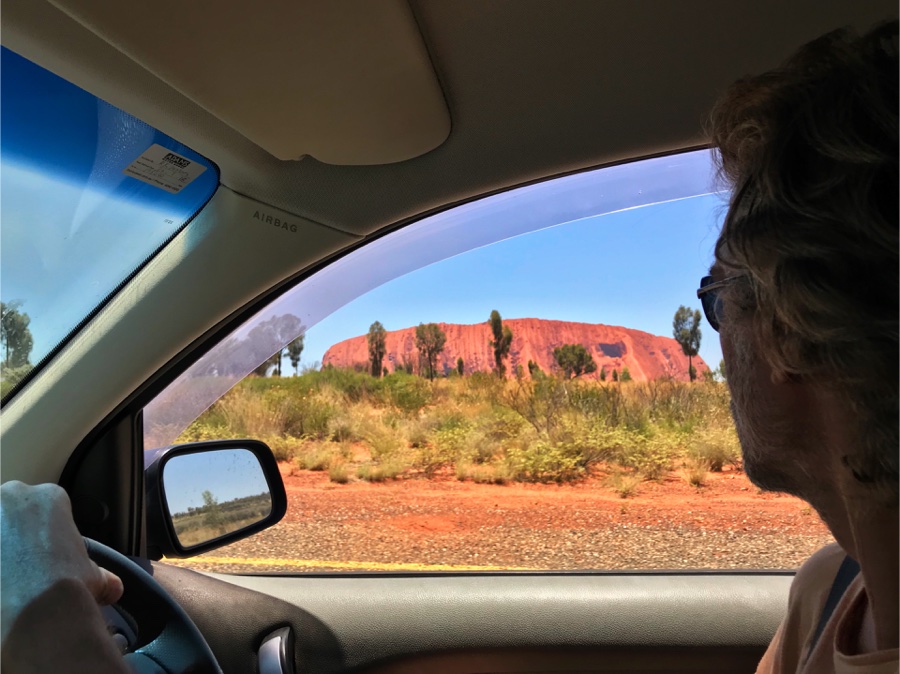
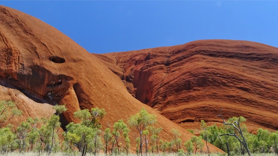
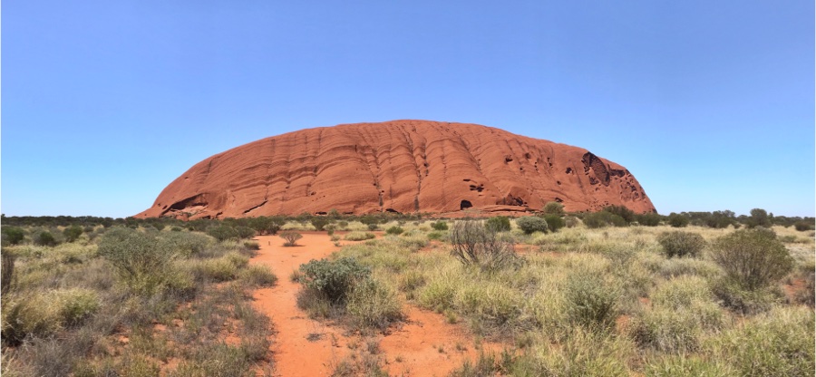 As soon as we see Uluru arise from the earth as we drive towards it, we know it’s been a good choice to make that 4000 kilometer detour. Boy oh boy that thing looks good!
 It is is now closed for climbing because of extreme temperatures in the summer period. There is a sign that says more than 35 people have not survived the climb. It appears the sign has been there for many years and they’ve stopped counting after that. For climbing there is a very steep way up with just some poles to hold on to. Eventhough some think they should, I think we should respect the Aboriginals wishes and beliefs. Respect the holy ground. From 2019 it is no longer allowed to climb Uluru.


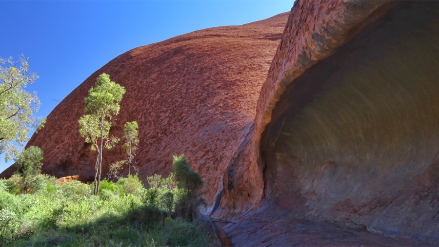
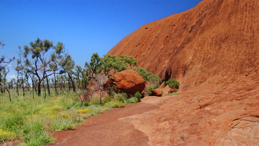
 We take the long route, this is called the basewalk and it goes all the way around the mountain for 10 kilometres. The path is wide and open but very charming and the there are enough trees to hide under for a drink. The trail is really beautiful, amazing bird life and every side of the rock has a different shape… it seems to change colours along the way. Halfway there is a tap with drinking water so we refill our bottle. Eventhough we think we drink enough we still feel somewhat dehydrated already. The air is so dry here you can feel it on your skin. We have a flaky haze over our skin and our lips are very dry.
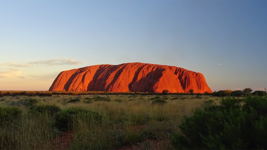
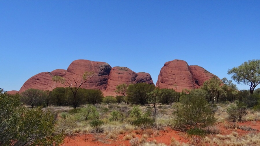
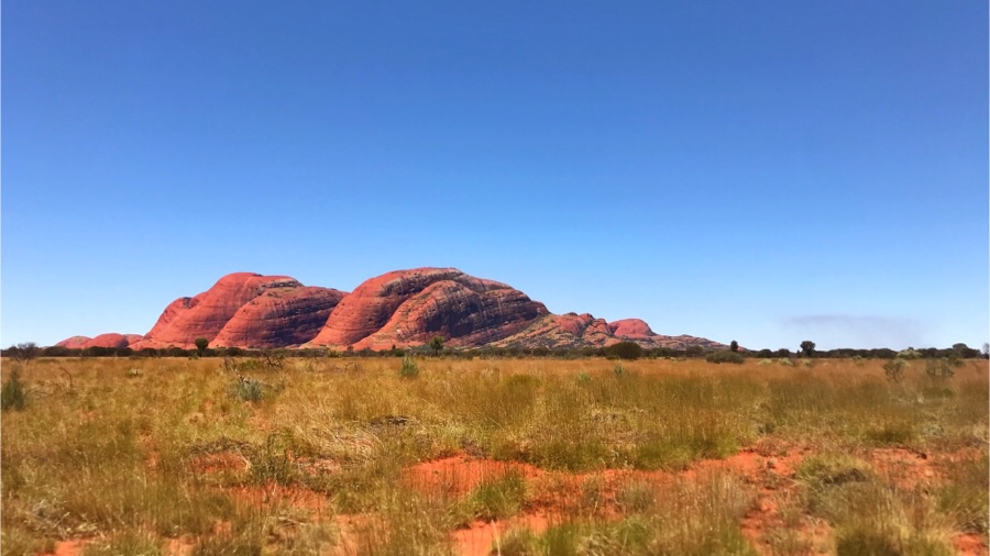
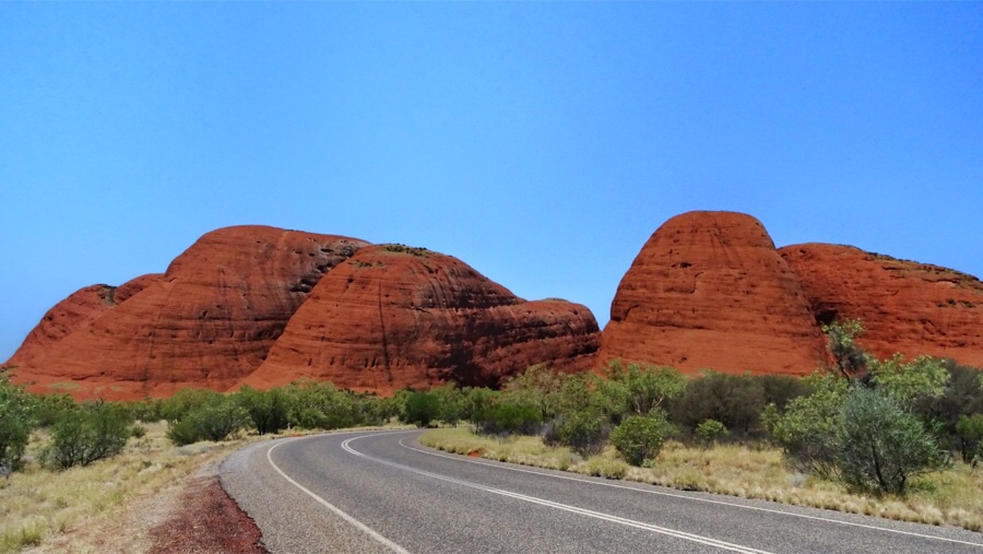 About 40 kilometers west of Uluru there is another gorgeous product of nature, or shall I say Cultural Heritage. Kata Tjuta, also known as The Olga’s (not a very sexy name) Kata Tjuta is a set of round boulders with a height of 1066 meters and cover an area of 21 square kilometres. These impressive red round rockies are certainly at least as beautiful as their big brother Uluru. There are two hikes allowed in the area which lead you through the immense chasms of the mountains.
 Unfortunately we are not in the luxurious position to do every hike we want to, the temperatures are rising again and decisions have to be made. Because of the high temperatures in this dry area it’s strongly advised to end your hike by 11 am, so we are much too late.
After our fantastic 10 kilometer hike around Uluru it’s already 2 pm and we can still feel the consequences of walking in warm dry weather. Tomorrow will be an even hotter day so we’ll just enjoy Kata Tjuta today from a short distance. Bummer.After visiting the park, we sell our two tickets that are only valid for one more day, to our neighbours on the campground for $ 10.00 each. Win-win I’d say 🙂
 This huge canyon in Wattarka National Park, 300 kilometers north of Uluru is supposed to be an absolute highlight.
You can imagine Kings Canyon as a crown of canyons that give you an incredible view you can only see by hiking around the rim and the down to the Garden of Eden… oh yes we have such high expectations of this promising kingdom.
Coming from Alice Springs you pass this canyon when you go west and take the 4 wheel drive road, called the Mereenie bend.
This road will actually take you just as long as driving all the way around over Stuart Highway, even with a 4 x 4.
 We took the highway and chose to go to Uluru first because of the temperatures. We figured Kings Canyon would be cooler because of the altitude of 600 meters, but we were wrong.
It takes about four hours to go round the 6 kilometer trail on the rim, so it’s really necessary to do this on a cool day. We would love to see Kings Canyon, but the weather forecast says no. The wind is turning again and more heat is coming our way. In the next few days temperatures will rise up to 40 degrees or higher and the last thing we want is to drive all the way to this breathtaking view just to see it from the car.
A hard decision but we skip Kings Canyon… for now…
 We stop at the intersection of Stuart Highway and Lasseter Highway for the night. Erldunda Roadhouse has a campsite with pool, a bar/restaurant, a petrol station (add $ 0.70 per liter) and a small really expensive supermarket (add $ 3.00 per item)
The campsite has no kitchen, so we use our own cooker. This is the first campsite without a fridge so we have to keep our veggies in the esky. We can’t refreeze our ice blocks so in the morning everything is lukewarm. Yuck.
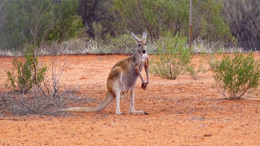
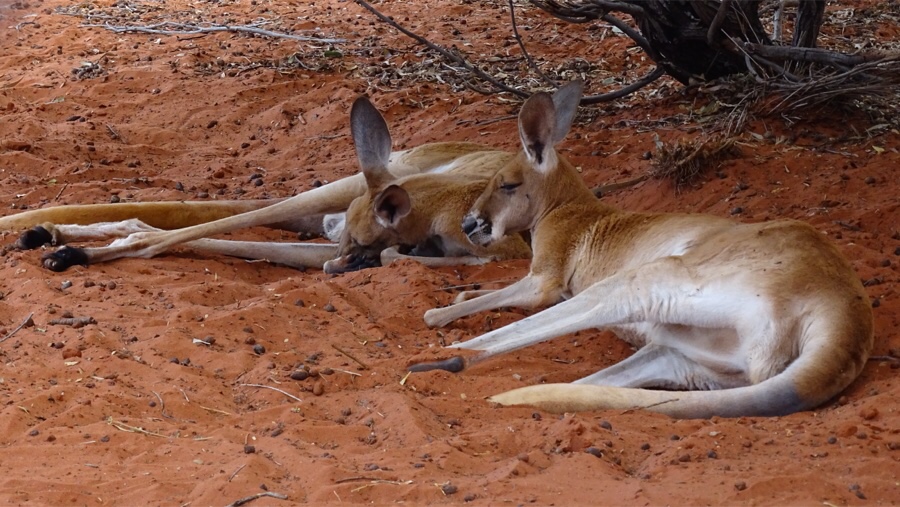 We find a nice spot in the shade with a scenic view. On the Kangaroo farm next to the campsite, the kangaroos are relaxing the sun, they look really funny laying on their back, scratching their balls, yawning… it’s so hot, I’d lie down and scratch my balls if I could!
Lets go to the pool to cool down! Yep, that helps. And we’ve heard there’s happy hour in the bar pretty soon. My son bought us a beer so we’re gonna enjoy that one extra well. Happy hour in this bar means 20% off, which leaves it to $ 6.00 per bottle of 330 ml… cheers mate!
Next to the campground there a dromedary asking for attention. He’s growling loud and when someone visits his neighbouring Kangaroos he’s stamping his feet but gets ignored. Poor fellah, all alone in his fenced sands… he needs some cheering up so I sing him a Christmas song.
There are a lot of ants everywhere on the campground, I mean A LOT… EVERYWHERE! We have a bad experience with ants in Australia so in the morning we leave as early as possible. Make that 8 am, we love our ‘take it easy-breakfast’…


 We continue Stuart Highway through an empty terrain. There are low dry bushes and now and then some higher green bushes.
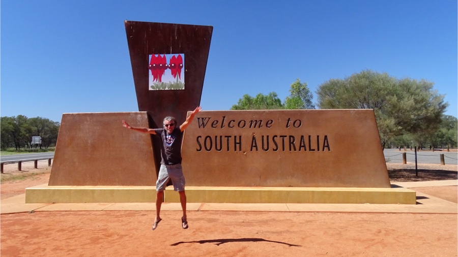
The border from Northern Territory to South Australia along Stuart Highway is about 95 kilometers south of Erldunda Roadhouse on the intersection. The border is no big deal, there is a rest stop where we take a short break. We say goodbye to the Northern Territory. What an unexpected pleasure this was…
South Australia here we come!

One Comment
Reisfreaks
Heerlijk hoor! Ik ben weer helemaal up to date 🙂